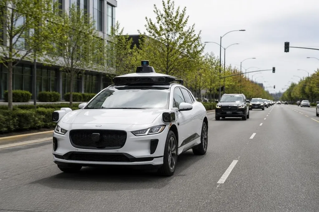
Autonomous vehicles are getting better because several systems now share the task of operating on the road. Cameras, radar, LiDAR, maps, and control software each cover a different part of the road problem.
That change matters to an engineer or fleet manager deciding where automation can work. The vehicle may handle a route well, yet still need a person ready for roadwork, poor weather, or a blocked lane.
- Sensors build a view of nearby traffic, road edges, and obstacles.
- Software turns that view into a path, speed, and braking choice.
- Testing now focuses more on unusual road events than on empty lanes.
More sensors, fewer blind spots
A camera can read lane markings and traffic signs. Radar can measure distance and the speed of nearby objects. LiDAR uses laser pulses to build a three-dimensional view of the space around the vehicle.
Each sensor has limits. A camera can lose detail in glare or darkness. Radar can be less useful for telling one object from another. LiDAR can return poor data in heavy rain, snow, or dust. Using several sensor types gives the software more than one source for a decision.
Its software also checks whether those sources agree. If a camera sees an open lane while radar detects an object ahead, the system can slow down and ask for more information. That extra caution matters because a wrong lane change has a much higher cost than a short pause.
Software turns perception into action
Seeing a pedestrian is only one part of driving. The vehicle must predict where that person may move, keep a safe path, obey the road rules, and leave room for a sudden change.
This work runs through several software steps. Perception identifies objects. Prediction estimates their next movement. Planning chooses a path. Control sends commands to the steering, brakes, and motor.
Better computing lets those steps run more often and with more detail. A vehicle can update its view as a cyclist moves beside it or as a parked car narrows the lane. The gain comes from repeated decisions made in a short time, not from one clever feature.
Maps add another layer. A detailed road map can mark lanes, crossings, speed limits, and fixed hazards before the vehicle arrives. The sensors still need to check the road because construction and parked vehicles can make the map wrong.
Training now includes the awkward cases
Open roads are useful for early testing because the vehicle has fewer objects to track. They don't show the full problem. A blocked lane, an emergency vehicle, a person directing traffic, or faded road paint can force the system outside its usual plan.
Engineers can test some of these events in simulation, then compare the result with closed-course and public-road tests.
Each test adds data about what the sensors saw, what the software chose, and where a human had to step in. That process helps teams fix a narrow failure instead of treating “autonomous vehicle operation” as one large task.
The work still has a limit: a system that handles a mapped route may not handle a new city with different signs, road rules, or weather.
That gap makes dated road tests more useful than broad claims about progress. Autonomous vehicle reporting from Robot24.com can tie a system’s sensor setup, route, weather, and operator role to what happened on the road.
Where progress still stops
A vehicle can be good at keeping its lane and still struggle with rare events. Heavy rain can hide lane lines. Snow can cover road edges. Temporary signs can conflict with map data. Human drivers may also behave in ways the software did not expect.
Safety depends on more than the control model. The vehicle needs a clear handoff process, reliable brakes and steering, a safe response when a sensor fails, and a way to record what happened after an incident.
Public claims need the same care. A short video can show that a vehicle completed one route. It can't show how often the system stopped, how many safety drivers were present, or which conditions were excluded. Those missing details decide how much trust the result deserves.
I'd treat a wider operating area as useful progress only when the limits are written down and tested.
A practical check before deployment
Use this list when you assess an autonomous vehicle for a fixed route or fleet:
- Route limits: Record the roads, speeds, weather, and times the system supports.
- Human role: State when a safety driver must take control and how that handoff works.
- Sensor faults: Test what happens when a camera, radar, or LiDAR unit stops sending data.
- Road changes: Check how the vehicle handles construction, blocked lanes, and new signs.
- Review records: Ask for logs that show stops, takeovers, and failed route attempts.
- Cost of fallback: Plan staff time and manual control for trips the system cannot finish.
The next useful measure isn't a claim that a vehicle operates without a person. It is a clear record of where it operated, what stopped it, and how often a person had to take over. That record tells you whether the system fits your route today.